

Introduction
The world of Game of Thrones Map is vast and intricately detailed, spanning continents, kingdoms, and cities that play crucial roles in the story. The Game of Thrones map covers Westeros, Essos, and other distant lands, giving viewers a visual understanding of the political and geographical dynamics.
Fans of both the books and the TV series often reference the map to track the journeys of characters and the locations of significant events. This guide explores the entire map in detail, explaining how each area contributes to the overarching narrative.
Exploring the Game of Thrones World Map
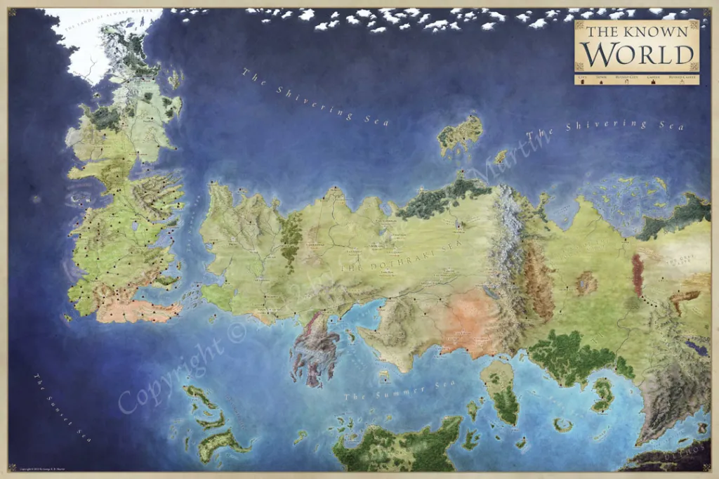
The Game of Thrones world map encompasses two primary continents: Westeros and Essos. Westeros, home to the Iron Throne and the Seven Kingdoms, is where much of the political drama unfolds. Essos, a sprawling landmass to the east, is known for its vast deserts, ancient cities, and mysterious cultures.
[To the far north lies the Lands of Always Winter, while the southern regions, like Sothoryos, remain largely unexplored. The show’s intricate map not only aids in storytelling but also helps fans grasp the scale of the conflicts, showing how geography influences the fate of the characters. For a deeper dive into the lore, check out What Are the Seven Kingdoms in Game of Thrones, as it provides insight into the distinct regions that make up this fascinating world.]
What is the Game of Thrones Map Based On?
The Game of Thrones map is fictional but draws inspiration from real-world geography. George R.R. Martin, the author of A Song of Ice and Fire, has admitted that certain locations are loosely based on historical Europe, particularly medieval Britain.
For example, Westeros resembles the United Kingdom, with the Wall inspired by Hadrian’s Wall in northern England. Similarly, Essos bears some resemblance to parts of Asia and the Middle East. Despite these influences, the map is wholly unique, with fantastical elements such as dragons, White Walkers, and vast, diverse kingdoms that don’t have direct counterparts in our world.
Is There a Map of Game of Thrones?
Yes, there are several maps of Game of Thrones available, including ones featured in both the books and the TV series. The opening credits of the show famously feature a detailed, animated map, highlighting key locations for that episode.
Many fans also create their own versions of the map, some of which offer interactive elements, helping users track character movements or explore lesser-known regions. In the official books, detailed maps are provided at the beginning of each novel, giving readers a sense of the terrain and how the various regions fit together within the world of Westeros and Essos.
How Realistic is the Game of Thrones Map?
While the Game of Thrones map contains many fantastical elements, it remains grounded in a sense of realism. The geographical features, such as mountains, rivers, and seas, are designed in a way that feels natural. The political divisions of Westeros are reminiscent of medieval feudal societies, with each kingdom having its own distinct culture and landscape.
Additionally, travel times between regions, as seen in both the books and TV show, reflect the challenges of moving armies and people across such a vast continent. Despite the fantasy elements like dragons and White Walkers, the map is consistent and feels logical within the context of the story.
Westeros and the Seven Kingdoms
Map of Westeros: The Seven Kingdoms Explained
Westeros is divided into seven major kingdoms, though it actually consists of nine distinct regions. These include the North, ruled by the Starks; the Riverlands, governed by the Tullys; and the Stormlands, under the control of the Baratheons.
Each of these regions contributes to the rich political landscape of the show, with their own noble houses, castles, and traditions. The Seven Kingdoms get their name from the original kingdoms that existed before the Targaryens united them under one rule. Understanding the map of Westeros and its Seven Kingdoms is crucial for following the complex political alliances and wars throughout the series.
What Are the Seven Kingdoms in Game of Thrones?
The term “Seven Kingdoms” refers to the major regions of Westeros before the Targaryen conquest. These were:
- The Kingdom of the North
- The Kingdom of the Mountain and the Vale
- The Kingdom of the Isles and Rivers
- The Kingdom of the Rock
- The Kingdom of the Stormlands
- The Reach
- Dorne
Though Westeros now contains nine regions, the name “Seven Kingdoms” persists. These seven were once independent realms before Aegon the Conqueror unified them. Today, they make up the foundation of power struggles in the Game of Thrones universe, with their rulers competing for dominance over the Iron Throne.
The Seven Kingdoms Map: A Visual Breakdown
The Seven Kingdoms map offers a detailed look at the regions and their key cities. In the North, Winterfell is the main stronghold, while the Vale boasts the impressive Eyrie. In the west, Casterly Rock towers over the Lannisters’ lands, while the rich farmlands of The Reach are centered around Highgarden.
Each kingdom is defined not only by its ruling family but also by its geography, with rivers, mountains, and coasts shaping the lives and politics of the inhabitants. A visual breakdown of the Seven Kingdoms helps fans follow the allegiances, conflicts, and wars that define the series.
Game of Thrones Westeros Map: Key Locations
The Game of Thrones map of Westeros features many important locations where key events unfold. King’s Landing, the capital of the Seven Kingdoms, is the center of power where the Iron Throne resides. To the north lies Winterfell, home of the Starks, while the Eyrie stands as an almost impregnable fortress in the Vale.
Dragonstone, a volcanic island off the eastern coast, holds great importance in the Targaryen dynasty. The Wall, located at the far northern edge, separates the realms of men from the dangers beyond. Understanding these key locations on the map provides insight into the strategic moves made by characters throughout the series.
Exploring Westeros: A Map of Major Cities and Landmarks
Exploring the map of Westeros reveals a rich tapestry of cities, castles, and natural landmarks. King’s Landing, the political capital, is a bustling city filled with intrigue. In contrast, Winterfell in the North is a more rugged, fortified castle. The Iron Islands, home to the Greyjoys, are a harsh and unforgiving region, while Dorne in the south is known for its hot climate and passionate people.
Landmarks like The Wall, The Eyrie, and Harrenhal are strategically significant, with each playing a role in the overarching power struggles. Exploring these cities and landmarks gives fans a deeper appreciation for the complex world of Game of Thrones.
Essos and Beyond
The Game of Thrones Map: Essos Explained
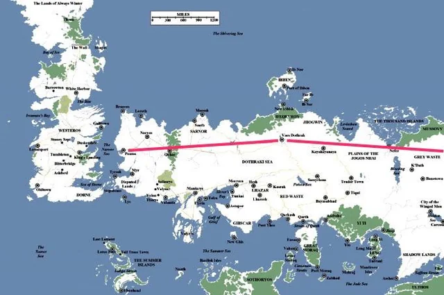
Essos, the vast continent to the east of Westeros, plays a significant role in the Game of Thrones universe. While Westeros may be more familiar to viewers, Essos is equally crucial, offering a rich landscape filled with diverse cultures, cities, and histories. The Essos map introduces viewers to massive cities like Braavos, Pentos, Qarth, and Meereen, each with its own unique culture and importance in the story.
One of the defining features of Essos is its sheer size. It stretches far beyond what we see in the series, housing The Dothraki Sea, Slaver’s Bay, and the mysterious lands of Asshai. While Westeros is largely characterized by noble families and rigid political structures, Essos presents a more chaotic, freewheeling world where power shifts more unpredictably. The continent is known for its mercenary armies, thriving trade routes, and rich cities, often controlled by merchant guilds or despots. Essos serves as the backdrop for key plotlines in Game of Thrones, especially Daenerys Targaryen’s journey to reclaim the Iron Throne.
A Complete Map of Essos in Game of Thrones
When looking at the complete map of Essos, viewers can see how vast and varied this region is. To the west of Essos, near the Narrow Sea, are wealthy and cosmopolitan cities such as Pentos and Braavos, while the far east remains mysterious and largely uncharted, with places like Yi Ti and the Shadow Lands.
A crucial feature of Essos is Slaver’s Bay, a region known for the cities of Meereen, Yunkai, and Astapor. This area plays a central role in Daenerys Targaryen’s storyline as she seeks to liberate the enslaved populations there. To the north of Slaver’s Bay lies the Dothraki Sea, a vast steppe inhabited by the Dothraki, nomadic horse-riders who live by raiding and conquest. Essos also contains Volantis, the oldest of the Free Cities, and Qarth, a rich trade city located along the Jade Sea.
Despite its prominence, much of Essos remains unexplored in the show and books, leaving fans to speculate about the lands far beyond the cities we know. The Game of Thrones map of Essos offers a glimpse into these exotic and dangerous regions, showing that Essos is as diverse and compelling as its neighboring continent, Westeros.
What Lies East of Essos in the Game of Thrones Map?
Beyond the well-known cities of Essos lies the eastern edge of the map, a place filled with mystery and intrigue. While much of Essos is mapped out, the lands east of Slaver’s Bay and the Dothraki Sea are largely unknown. The most mysterious of these locations is Asshai, a shadowy city at the far eastern end of the continent, said to be a place of dark magic and ancient power.
Beyond Asshai lies the Shadow Lands, a region spoken of in hushed tones. This distant and almost mythological place is rumored to be home to dark forces, with stories of demons, dragons, and powerful sorcerers. Additionally, there is Yi Ti, a wealthy and ancient empire said to rival even the grandeur of Valyria in its prime.
Though these regions are only mentioned briefly in Game of Thrones, fans have speculated about their significance. The world east of Essos offers endless possibilities, with its culture, magic, and history offering a stark contrast to the more grounded politics of Westeros.
The Dothraki Sea and Slaver’s Bay on the Game of Thrones Map
The Dothraki Sea is a sprawling grassland that stretches across central Essos, inhabited by the Dothraki, a fierce nomadic people known for their mastery of horseback riding and raiding. The Dothraki Sea is not an actual sea but a vast plain of rolling grasses, where the Dothraki tribes, or khalasars, roam freely. It is a crucial location in Daenerys Targaryen’s journey, as it is where she first meets her future husband, Khal Drogo, and learns about the harsh lifestyle of the Dothraki.
To the south of the Dothraki Sea lies Slaver’s Bay, home to the infamous cities of Astapor, Yunkai, and Meereen. These cities thrived on the trade of slaves, capturing people from all over the continent and selling them to the highest bidder. Slaver’s Bay becomes a major battleground in Daenerys’ quest to end the practice of slavery, with her campaigns to liberate these cities becoming central to her storyline in the series.
The Game of Thrones map shows these regions as vast and dangerous, filled with political and cultural complexity. While the Dothraki Sea represents freedom and nomadic strength, Slaver’s Bay embodies oppression and the struggle for liberation, making these areas key to the broader story of Game of Thrones.
Beyond Westeros: Mapping Essos and Beyond
While Westeros is often the focus of the story, Essos and the lands beyond offer a rich tapestry of cultures and civilizations that play crucial roles in shaping the events of Game of Thrones. From the Free Cities like Braavos and Volantis to the desert city of Qarth, Essos is a world of contrasts, where wealth and poverty, freedom and slavery, and power and weakness exist side by side.
Further east, beyond the Dothraki Sea, lies the fabled city of Asshai and the mysterious Shadow Lands, places known only through legend. These regions are rarely visited by the characters in the series, yet they hold a certain allure due to their exoticism and danger. The world beyond Westeros is vast and unknown, offering endless potential for exploration and adventure.
The Game of Thrones map gives us a glimpse of these distant lands, though much of Essos remains unexplored. Fans of the series are left to wonder what lies in the uncharted territories east of Essos, where dragons once roamed and where ancient sorceries may still hold sway.
Famous Locations
Where is Pentos on the Game of Thrones Map?
Pentos is one of the major cities on the western coast of Essos, located just across the Narrow Sea from Westeros. It is known for its wealth and is ruled by wealthy merchants known as Magisters. Unlike other Free Cities, Pentos has maintained a complicated relationship with the Dothraki, offering them tribute to avoid being raided.
In Game of Thrones, Pentos is where Daenerys and her brother Viserys Targaryen initially take refuge after fleeing Westeros. It’s also where Daenerys is married to Khal Drogo, setting in motion her rise to power. The city’s strategic location on the map makes it a hub for trade, politics, and cultural exchange between Westeros and Essos.
Where is Qarth in Game of Thrones?
Qarth, a city located on the southern coast of Essos, near the Red Waste, is known as the “Gateway of the East.” It is a major trading hub, and its wealth is legendary. Qarth is surrounded by three massive walls, each adorned with images of wealth and power, making it one of the most visually striking cities on the Game of Thrones map.
Qarth plays a significant role in Daenerys’ journey in Season 2, as she travels there after crossing the Red Waste with her small group of followers and her newly hatched dragons. While Qarth appears welcoming at first, the city’s rulers, the Pureborn and the Thirteen, have their own hidden agendas, making it a dangerous place for Daenerys and her dragons.
Mapping Braavos: A Key City in Game of Thrones
Braavos is one of the most important and powerful cities on the Game of Thrones map. Located on the northwestern coast of Essos, Braavos is unique in that it is ruled by a council of wealthy merchant families rather than kings or lords. The city is famous for its Iron Bank, which holds immense financial influence, and the Faceless Men, a secretive group of assassins who can change their appearance at will.
Braavos is also home to Arya Stark for much of her journey, as she trains with the Faceless Men in the House of Black and White. The city’s canals and water-based culture give it a distinctive feel, and its influence reaches far across both Westeros and Essos.
Where is Dragonstone on the Game of Thrones Map?
Dragonstone is a volcanic island located in the Narrow Sea, just off the coast of Westeros. It was the ancient seat of House Targaryen before they conquered the Seven Kingdoms. The island is known for its imposing castle, Dragonstone, which is built out of volcanic rock and overlooks the sea.
In Game of Thrones, Dragonstone plays a pivotal role as it is the ancestral home of Daenerys Targaryen and later becomes her base of operations when she returns to Westeros to reclaim the Iron Throne. The island’s strategic location makes it a key stronghold for anyone seeking to control Westeros.
Where is Meereen in Game of Thrones?
Meereen is the largest and most powerful of the three cities in Slaver’s Bay. Located to the northeast of Astapor and Yunkai, Meereen is known for its towering pyramids and vast slave population. It becomes central to Daenerys’ story as she conquers the city and attempts to rule it justly, ending the practice of slavery and facing numerous challenges in maintaining order.
Meereen also becomes a battleground as Daenerys’ enemies, including the Sons of the Harpy, seek to overthrow her rule. The city’s vast size and importance make it a key location on the Game of Thrones map, symbolizing both the promise and perils of leadership in the series.
Castles and Strongholds
Castles and Strongholds
The world of Game of Thrones is not only known for its intricate characters and plotlines, but also for its impressive array of castles and strongholds. These fortresses serve as the backdrop for key moments in the story, standing as symbols of power, legacy, and warfare.
From the icy Castle Black to the ancient Dragonstone, each of these strongholds holds immense strategic and historical importance in both the lore of Westeros and the show’s narrative. Understanding the locations of these castles on the map offers deeper insight into the geopolitical struggles of the Seven Kingdoms.
A Map of Castles in Game of Thrones
The map of Westeros and Essos is dotted with grand castles that house noble families, kings, and armies. Some of the most famous castles in Game of Thrones include Winterfell, the home of the Starks, Dragonstone, the ancestral seat of the Targaryens, and Castle Black, the headquarters of the Night’s Watch.
These castles aren’t just places of residence; they are also central to the defense of the realm and the control of surrounding territories. Exploring the map of these strongholds helps fans trace the political allegiances, battles, and key events that unfold within their walls.
Where is Castle Black on the Game of Thrones Map?
Castle Black, located near the far northern edge of Westeros, is one of the most iconic locations in the series. It sits at the base of the massive Wall, which separates the Seven Kingdoms from the dangers that lie beyond.
Castle Black is home to the Night’s Watch, a sworn brotherhood tasked with defending the realm from threats such as Wildlings and the supernatural White Walkers. On the map, Castle Black is positioned just south of the Wall, near the Haunted Forest and The Gift, a land granted to the Night’s Watch. Its remote location highlights the isolation and constant vigilance required by its defenders.
A Map of Dragonstone and Its Strategic Importance
Dragonstone is a volcanic island located off the eastern coast of Westeros, near Blackwater Bay. It has significant strategic importance due to its proximity to the capital, King’s Landing. As the ancestral seat of House Targaryen, Dragonstone played a pivotal role during Aegon’s Conquest of Westeros. The island’s rugged terrain and fortified castle make it a natural stronghold for any military campaign.
On the map, Dragonstone is shown as an island fortress situated on the narrow sea, serving as a key defensive position for naval battles and invasions. Its importance grows as Daenerys Targaryen claims it as her base of operations during her quest to reclaim the Iron Throne.
Highgarden on the Game of Thrones Map: A Strategic Location
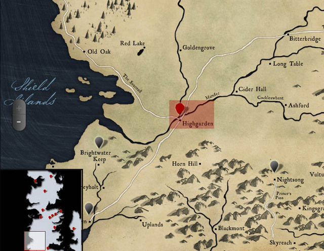
Highgarden, the seat of House Tyrell, is located in the fertile region of The Reach. It is known for its wealth, beauty, and vast agricultural lands, making it one of the most powerful and prosperous castles in Westeros. Highgarden’s strategic location on the map, nestled along the Mander River, provides a natural defense and easy access to vital trade routes.
It controls much of the southern portion of Westeros and serves as a key supplier of food to the rest of the realm, particularly during times of war. With its vast resources and influence, Highgarden played a crucial role in the alliances and conflicts that shaped the events of Game of Thrones.
Where is Harrenhal on the Game of Thrones Map?
Harrenhal is one of the largest castles in Westeros, located in the Riverlands, near the northern shore of the Gods Eye Lake. Despite its grandeur, Harrenhal is often regarded as cursed due to its troubled history and frequent changes in ownership.
On the map, Harrenhal is situated centrally in Westeros, making it a strategic stronghold for any faction seeking to control the Riverlands or launch attacks into neighboring regions. The castle’s vast size and impressive defenses make it a valuable asset, but its reputation for bringing misfortune to its lords adds a layer of mystery and dread to this imposing fortress.
The Wall and Northern Regions
The Wall and Northern Regions
The northern regions of Westeros are defined by their harsh climates and sprawling, untamed wilderness. At the heart of this icy expanse stands The Wall, a massive structure of ice that stretches across the continent’s northern border.
The Wall and the lands beyond it are home to some of the most mysterious and dangerous elements in Game of Thrones, including the ancient White Walkers and the Free Folk, also known as Wildlings. Understanding the geography of these regions is crucial for following the storylines that revolve around the battle for survival in the North.
Where is The Wall on the Game of Thrones Map?
The Wall is a colossal barrier of ice that runs from the western coast of Westeros to the eastern shores, separating the Seven Kingdoms from the wild, untamed lands to the north. It stands as a symbol of the realm’s defense against the unknown forces that dwell beyond. On the map, the Wall is located at the extreme northern edge of Westeros, stretching across the width of the continent.
The Night’s Watch guards the Wall, with Castle Black being one of its main fortifications. The Wall serves not only as a defensive structure but also as a dividing line between the civilized south and the wild, dangerous north.
A Map of the North in Game of Thrones
The North is the largest of the Seven Kingdoms in terms of territory, known for its cold climate, vast forests, and strong traditions. It is home to noble houses such as House Stark, with their ancestral seat at Winterfell.
On the map, the North stretches from the Neck, a narrow land bridge connecting it to the rest of Westeros, up to the Wall. Major locations within the North include Winterfell, The Dreadfort, and Last Hearth. The region’s harsh environment and isolation have shaped its inhabitants into resilient, proud people who value loyalty and honor above all else.
Mapping Beyond the Wall in Game of Thrones
Beyond the Wall lies a vast and dangerous wilderness, home to the Free Folk (or Wildlings) and many other mysterious creatures. This region is sparsely populated, with the terrain consisting of icy plains, mountains, and dense forests.
On the map, Beyond the Wall stretches north from the Wall to the Land of Always Winter, a place said to be inhabited by the ancient White Walkers. The lack of defined borders and settlements in this area emphasizes the wild and untamed nature of the land. Jon Snow and other members of the Night’s Watch venture into this dangerous territory, leading to some of the most significant plot developments in the series.
The Wall in Game of Thrones: A Geographical Overview
The Wall is one of the most significant landmarks in Westeros, standing over 700 feet tall and stretching for hundreds of miles across the continent. Constructed from ice, the Wall has stood for thousands of years as a defense against the dangers lurking in the far north. Its location on the map is key to understanding the geographical and political landscape of the North.
The Wall’s construction was attributed to Bran the Builder, and it has been manned by the Night’s Watch ever since. Its sheer size and isolation create a sense of foreboding, and its role in the defense of the realm is central to the unfolding of events in Game of Thrones.
The Free Folk and Their Lands on the Game of Thrones Map
The Free Folk, commonly referred to as Wildlings by those south of the Wall, live in the lands north of the Wall, beyond the control of the Iron Throne. On the map, the territory of the Free Folk extends into the far reaches of the Frozen North, beyond the Haunted Forest and towards the Lands of Always Winter.
Unlike the structured kingdoms of Westeros, the Free Folk live in loosely organized tribes, valuing freedom over the hierarchical systems of the Seven Kingdoms. Their lands are harsh, unforgiving, and dangerous, but the Free Folk’s resilience and adaptability have allowed them to survive in these conditions for centuries.
Valyria and Ancient Lands
Where is Valyria in Game of Thrones?
Valyria, a legendary and once-powerful civilization in Game of Thrones, is located in the far southeast of Essos, across the narrow sea from Westeros. Known for its incredible mastery of magic and dragon-riding technology, Valyria was the center of the Targaryen dynasty’s ancestry and the birthplace of dragons. However, the Doom of Valyria, a catastrophic event, led to its downfall and turned the region into a dangerous wasteland. Valyria is no longer inhabited, but its ruins still hold significant historical importance.
Despite its fall, Valyria’s influence remains crucial in the lore of Game of Thrones, especially for House Targaryen, who escaped the Doom and settled in Dragonstone, a coastal island in Westeros. Valyria’s exact location on the map is somewhat shrouded in mystery, and it plays a pivotal role in many key events of the series. The ruins of Valyria symbolize both the power and the tragedy of a civilization that once dominated the known world.
Exploring the Ruins of Valyria on the Game of Thrones Map
The ruins of Valyria, known as the “Smoking Sea,” are scattered across a large stretch of land in Essos. The area is largely uncharted, and the few survivors who have ventured into it have returned with tales of destroyed cities, crumbling towers, and vast pits of fire. On the map, Valyria is depicted as a massive landmass along the eastern coast of Essos, but its interior is mostly obscured by an eerie fog and smoke, a result of the magical catastrophe known as the Doom.
The ruins are home to dangers like wild dragons, the “stone men,” and other horrific creatures, making it a region that few dare to explore. Despite this, the area still holds ancient secrets, including forgotten dragons’ eggs, which many believe could hold the key to the Targaryens’ power over dragons. Exploring the ruins of Valyria is more than just an adventure—it’s a voyage into the history of the ancient world and the source of many mysteries in Game of Thrones.
Old Valyria on the Game of Thrones Map: A Forgotten Civilization
Old Valyria, now referred to as the “Smoking Sea,” was once a thriving civilization known for its vast technological and magical advancements. Its people were capable of dragon-riding, casting spells, and shaping the world to their will. The Game of Thrones map reflects Old Valyria’s place in history by showing its ruins and the surrounding areas. Although most of the world believes Valyria to be a myth, its ruins serve as proof that this ancient civilization was once a major player on the global stage.
Valyria’s influence is especially seen in the Targaryen bloodline, which traces its ancestry back to the Valyrians. The Targaryens, one of the key houses in Game of Thrones, are the only known family to have survived the Doom of Valyria and still maintain the connection to the dragons that once ruled the skies. The ruins of Old Valyria are both a haunting reminder of their downfall and a source of immense potential for those who wish to reclaim that lost power.
Mapping Ancient Lands: Valyria and the Shadow Lands
In addition to the ruins of Valyria, another area of interest in Essos is the Shadow Lands, a mysterious and dangerous place that lies to the east of the known world. Located near the eastern coast of Essos, the Shadow Lands is home to dark magic and mysterious beings. The map of Game of Thrones places these lands far from Westeros and Valyria, adding to their aura of mystery.
The Shadow Lands are also significant in the Game of Thrones storyline, particularly when we look at the role they play in the rise of characters like Melisandre, who hails from this region. These lands are believed to hold ancient powers, and the interplay between Valyria and the Shadow Lands suggests that both regions played an important role in the shaping of magic and destiny in the world of Game of Thrones.
The Mystery of Oldtown and the Citadel in Game of Thrones
Oldtown, located in the Reach of Westeros, is one of the oldest cities in the Seven Kingdoms and plays a crucial role in the events of Game of Thrones. On the Game of Thrones map, Oldtown is shown at the southern tip of the continent, with its towering Citadel being the focal point of learning and knowledge. The Citadel houses the Maesters, scholars who serve the ruling houses of Westeros with their wisdom and knowledge.
While Oldtown is known for its education and history, it also harbors its own secrets. For instance, it is home to the Hightower, one of the most ancient and revered structures in Westeros. The Citadel, and the knowledge it holds, plays a vital role in the story as it influences the strategic decisions of key players like Samwell Tarly and Jon Snow in the series.
Geographic and Political Maps
The Political Map of Westeros: Kingdoms and Houses
Westeros, the main setting of Game of Thrones, is divided into seven distinct kingdoms, each ruled by a noble house. These houses, including the Starks, Lannisters, and Baratheons, all play significant roles in the complex political landscape of the series. On the political map of Westeros, the Seven Kingdoms are depicted as individual regions, with each one having its own culture, laws, and politics.
Understanding the political map is essential for following the intricate storylines of Game of Thrones. The map not only helps to visualize the locations of each house and their strongholds but also provides insights into the power dynamics and rivalries that drive the plot. Whether it’s the North, ruled by House Stark, or the Riverlands under House Tully, the map illustrates how geography and power are closely intertwined in the Game of Thrones universe.
Game of Thrones Map with Houses: Territories and Alliances
The map of Game of Thrones not only showcases the physical locations of each kingdom but also reveals the intricate alliances and rivalries between the noble houses. Each house controls different territories, and their power is often determined by their geographical location and access to resources. The Game of Thrones map with houses helps fans understand the political relationships and military strategies that define the power struggles in Westeros.
From the mountainous regions of the Vale to the vast plains of the Reach, the map highlights how each house’s territory influences its wealth and influence. Alliances, such as the one between House Stark and House Tully, or the more sinister plans of House Lannister, are often shaped by geography and proximity to one another.
A Map of the Known World in Game of Thrones
While the story of Game of Thrones is mainly set in Westeros and Essos, the map also alludes to the existence of unknown lands beyond these regions. The known world in Game of Thrones refers to the land that the inhabitants of Westeros and Essos are familiar with, but this only scratches the surface of the larger world. On the map, you can see territories like the Shadow Lands and Yi Ti, regions that are distant and foreign to most characters in the story.
Exploring the known world map gives fans a sense of how vast and complex the world of Game of Thrones truly is. While the focus is on Westeros, the existence of these distant lands raises important questions about the larger forces at play, such as the Others or the White Walkers, whose origins may lie far from the lands we see.
The Geography of Westeros and Essos in Game of Thrones
The Game of Thrones world is split between the continents of Westeros and Essos, each with its own geography that shapes the story. Westeros is characterized by mountain ranges, forests, rivers, and vast plains, while Essos is home to deserts, the Dothraki Sea, and sprawling cities like Braavos and Qarth. The geography of both continents plays a vital role in the plot.
Westeros’ geography is important because it determines the climate and lifestyle of each kingdom. The North, for example, is cold and harsh, which shapes the resilience and ruggedness of House Stark. In contrast, the southern regions of Westeros are much warmer and have fertile lands, leading to the wealth and power of House Tyrell in the Reach.
How Does the Game of Thrones Map Match Our World?
The Game of Thrones map has often been compared to real-world geography. While the map of Westeros and Essos is fictional, many locations in the series resemble real-world places. For example, the Iron Islands are said to be inspired by the rugged coasts of Scotland, while the Dothraki Sea is similar to the steppes of Mongolia.
However, the creators of Game of Thrones deliberately designed the world to reflect a variety of global influences. This blend of real-world geography with fantasy allows fans to immerse themselves in the fictional world, while also recognizing familiar landmarks. The connections between the fictional map and our world help to make the story feel more tangible, even though it takes place in a completely different universe.
Interactive and Fan-Made Maps
Game of Thrones Interactive Map: Explore Westeros and Essos
The Game of Thrones Interactive Map provides an immersive way for fans to explore the vast and intricate world of Westeros and Essos. It allows users to virtually travel across the Seven Kingdoms, exploring iconic locations such as Winterfell, King’s Landing, and Dragonstone. With this interactive tool, you can zoom in on cities, key landmarks, and even lesser-known regions, like the Free Cities of Essos and the desolate land beyond the Wall.
The map also offers users the chance to view detailed information about each location, including notable events, battles, and character connections. By interacting with the map, fans can trace the journeys of their favorite characters, helping them visualize how the epic story unfolds across different regions. This interactive map is an essential resource for anyone looking to deepen their understanding of the Game of Thrones universe.
How to Draw the Game of Thrones Map: A Step-by-Step Guide
If you’re a fan of both Game of Thrones and drawing, creating your own version of the Game of Thrones map can be an exciting project. Here’s a step-by-step guide to help you draw the map of Westeros and Essos, ensuring you capture the intricate details of this vast world. First, start by sketching the rough outline of the continent of Westeros on your paper.
Use a pencil to lightly mark the shape of the land, noting the different regions such as the North, the Riverlands, and the Reach. Next, begin drawing the individual kingdoms, paying attention to their unique shapes and boundaries.
For Essos, focus on the Free Cities and major locations like Braavos and Meereen. Once you’re happy with the layout, add details such as rivers, mountain ranges, forests, and key landmarks. Finally, darken the lines with ink or marker, and color the map using shades that represent each region’s character – from the icy North to the sunny South. You can even label important locations for a complete map!
Fan-Made Maps of the Game of Thrones World
Fans of Game of Thrones have taken their love for the series to another level by creating their own fan-made maps of the world. These fan-made maps can be found online, offering alternative perspectives and interpretations of Westeros and Essos.
Some fans focus on details that the official maps leave out, such as the Dothraki Sea, or provide new insights into Old Valyria or the Shadow Lands. These maps are not only visually stunning but also bring new theories and lore into the conversation, making them an excellent resource for deep-dive fans. While fan-made maps may differ from official sources, they are valuable for understanding the complexities of the Game of Thrones universe and showcasing the creativity of the fandom.
Where to Buy a Game of Thrones Map Poster
If you’re looking to decorate your home with an iconic Game of Thrones map poster, you’re in luck. Several websites and specialty stores offer high-quality posters of both Westeros and Essos, ideal for fans who want to have a detailed visual of the world.
You can check out online marketplaces such as Etsy, Amazon, or eBay for a wide range of posters featuring the map of the Seven Kingdoms. Whether you prefer a vintage-style map, a sleek modern design, or a fan-made artistic version, there are plenty of options to choose from. Additionally, some Game of Thrones merchandise stores sell exclusive, limited-edition maps, perfect for collectors.
Does Game of Thrones Map Go Farther East?
Many fans have wondered if the Game of Thrones map goes farther east beyond Essos. The official map stops at the Shivering Sea, which borders Essos, but does not reveal the full extent of the known world. There is limited information about what lies beyond, though some fan theories suggest that regions such as the mysterious Shadow Lands could extend even further.
It’s worth noting that the story primarily focuses on Westeros and Essos, with only glimpses of lands further east, so there’s much room for speculation. Does the map stop at the known world, or could there be even more undiscovered territories beyond?
Board Game and Media Adaptations
A Game of Thrones Board Game Map: Strategy Guide
The Game of Thrones Board Game allows players to experience the political intrigue and military conquests that define the Seven Kingdoms. One of the most exciting elements of the game is the board game map, which represents the geopolitical landscape of Westeros. The map is divided into territories controlled by different houses, and players must compete to claim the Iron Throne.
To succeed, you need to master strategy and take control of key regions such as the Riverlands or the Reach. The board game map also includes sea routes and coastal territories, offering plenty of opportunities for tactical maneuvering. By understanding the map, players can better plan their moves, forming alliances and deploying troops to expand their influence.
A Map of the Game of Thrones Board Game Second Edition
The second edition of the Game of Thrones Board Game features an updated version of the original board game map. This version expands on the previous edition, adding new elements such as additional territories, more detailed cities, and new mechanics to reflect the shifting power dynamics of Westeros.
The map in this edition is more detailed, with clearer borders and enhanced features like regions that represent the Wall or Dragonstone. If you are a fan of strategy games and Game of Thrones, this second edition offers a richer, more dynamic experience. Understanding the map is crucial, as it provides insight into which territories are valuable for control and which are vulnerable to attack.
Game of Thrones Map in the Book Series: A Comparison
The Game of Thrones book series offers a more detailed version of the world map than the TV show. While the show focuses primarily on Westeros and Essos, the books delve deeper into the geography of the Game of Thrones world, including regions like Sothoryos, Yi Ti, and the Lands Beyond the Wall.
In the books, the map is more detailed with additional places that never made it to the screen, such as the mysterious Shadow Lands. Fans of the series will find the book’s map much larger and richer in scope, offering more areas for exploration and additional lore that adds to the depth of the Game of Thrones universe.
Game of Thrones Genesis Maps: Download and Explore
If you are a fan of Game of Thrones and love to explore the world through maps, the Game of Thrones Genesis video game offers downloadable maps that let you explore Westeros in a new way. The Genesis maps are interactive and feature various regions such as the North, Riverlands, and Stormlands.
These downloadable maps allow players to navigate and interact with the territories, mimicking the political and military strategies of the series. By downloading the maps, players can explore key locations like Dragonstone or King’s Landing and understand how they fit into the overall story of Game of Thrones.
Game of Thrones Map in the Board Game: Key Locations
The board game map of Game of Thrones is designed with strategic locations that closely mirror the world of Westeros. Some of the key locations on the map include Winterfell, King’s Landing, Dragonstone, and The Wall.
Each of these areas has strategic importance, serving as points where battles for control of the Iron Throne take place. By understanding the geography of these key locations, players can make better tactical decisions, whether it’s launching a siege on the Riverlands or reinforcing their forces at Casterly Rock. The map’s layout is central to the gameplay, as controlling key territories can make or break a player’s chances of winning the game.
Character and Story Maps
A Game of Thrones Character Map: Tracking Key Players
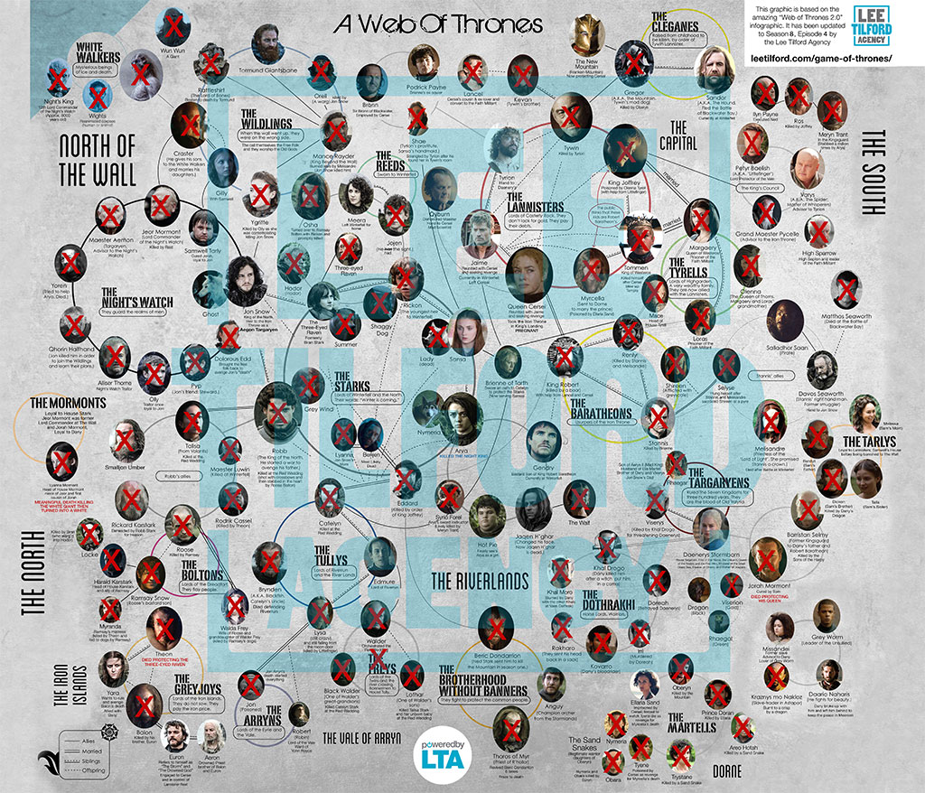
One of the best ways to understand the complex relationships in Game of Thrones is through a character map. This map tracks where key characters are located at different points in the series and how they interact with one another. From Jon Snow in the North to Daenerys Targaryen in Essos, a character map helps fans visualize how the characters’ paths cross and evolve over time.
It also shows important locations like Winterfell, King’s Landing, and Dragonstone, which are key to the characters’ journeys. This tool is invaluable for anyone trying to follow the intricate web of alliances, betrayals, and power struggles that define the show.
Where All the Characters Go in Game of Thrones: A Map Overview
As the characters in Game of Thrones travel across Westeros and Essos, it can be hard to keep track of where they are and how they interact with the rest of the world. A map overview of where all the characters go can help fans better understand the storyline.
By following their travels across the map, fans can visualize important moments such as Arya Stark’s journey to Braavos or Tyrion Lannister’s travels to Essos. This overview also highlights how the characters’ paths lead them to pivotal locations such as Winterfell, Dragonstone, and the Wall. It’s a great resource for fans who want to track character development through space and time.
A Game of Thrones Book Character Map: Visualizing Relationships
The Game of Thrones book character map provides a deeper understanding of the relationships between characters in the series. This map shows how various characters are connected, whether through family, political alliances, or rivalries.
The character map also tracks key events in the books, helping fans see how these relationships evolve. From Robb Stark’s alliance with House Frey to Daenerys Targaryen’s growing connection with Jorah Mormont, this map allows readers to keep track of the shifting power dynamics. If you’re a fan of Game of Thrones books, this visual aid can be essential for grasping the complex narrative.
Game of Thrones Map: The Path of Key Characters
Following the path of key characters in Game of Thrones can be difficult due to the vastness of the world. A character path map can show fans how different characters, such as Daenerys Targaryen, Jon Snow, and Cersei Lannister, move across Westeros and Essos.
This map tracks their journeys, from early storylines like Jon’s time at The Wall to Daenerys’s rise to power in Meereen. By visualizing their paths, fans can better understand how these characters’ fates become intertwined in the epic narrative of the Iron Throne.
A Map of Game of Thrones: Follow the Storylines
A map of Game of Thrones offers fans the opportunity to follow the many intertwining storylines. The map highlights key locations that are integral to the show’s plotlines, such as Winterfell, King’s Landing, and The Wall. By following these places on the map, viewers can trace where significant events occur and how they shape the course of the story.
The map also shows the different territories controlled by the various houses, helping fans understand the complex political landscape of Westeros. Whether you’re a casual viewer or a die-hard fan, this map is a fantastic tool for deepening your appreciation of the series.
Conclusion and Additional Resources
The world of Game of Thrones is vast and intricately designed, with its map helping fans to navigate through the complex storylines, locations, and key events. From the icy Wall in the north to the warm sands of Dorne in the south, every corner of the map is crucial to the series’ plot. With the show blending elements of fantasy, history, and politics, understanding the geography of Westeros and Essos provides deeper insight into the motivations and struggles of the characters.
For viewers, maps of Game of Thrones are not just geographical tools, but rather, an essential part of immersing themselves into the world of the Seven Kingdoms. If you’re a fan of the show or the books, it’s important to explore different maps that cover regions from across Westeros, Essos, and even the distant lands beyond. The Game of Thrones map is also a great resource for role-playing games and fan fiction, providing clarity on where major events and battles take place.
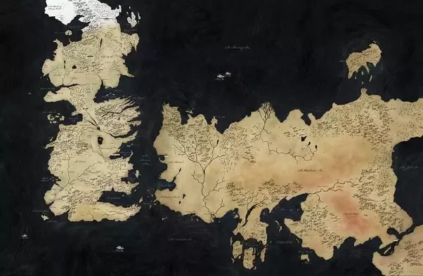
Complete Map of Game of Thrones World: Westeros and Beyond
The Game of Thrones world map is an expansive creation that spans beyond the shores of Westeros and Essos. Westeros, the primary setting of the show, is divided into several regions known as the Seven Kingdoms. But Essos, a vast continent to the east, holds its own set of rich, diverse landscapes, including Slaver’s Bay, the Dothraki Sea, and the Free Cities like Braavos and Pentos. These regions are not only important for the lore of the series but serve as critical locations where various plotlines unfold.
In addition to these well-known regions, the world map extends further to mysterious, lesser-explored areas such as Valyria, a land of ancient ruins, and Sothoryos, a largely unexplored jungle-filled land in the far south.
The map also includes the Summer Islands, a tropical paradise where little is known about its inhabitants and history. Although the map does not give us a full picture of every part of the world, it provides enough details for fans to explore the critical regions mentioned in the books and the show.
Conclusion
The intricate maps of Westeros and Essos in Game of Thrones reveal the vast and diverse landscapes that shape the series’ epic narrative. From the icy North to the sun-soaked lands of Dorne and the bustling cities of Essos, each location plays a crucial role in the power struggles and character journeys throughout the story. Understanding these regions enhances our appreciation of the intricate world-building and the rich tapestry of alliances and conflicts that define Game of Thrones.